Sunday, December 4, 2016

Chapter 5 50th Anniversary Trip

                                                50th Anniversary Trip

Chapter 5

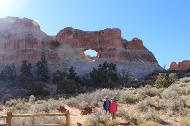
I found a few pictures left in the camera of the big red rocks around Moab, Utah, so I'll include them here.
Red rocks, many with petroglyphs, along the Colorado River

Fascinating rock formations

High up on the mountain of the Lafal range

From Utah, we made our way to Colorado to view the indian pueblos in that area.  Mesa Verde National Park includes the most complete housing complex called Spruce Lodge.  These particular houses were built high up on the ledges in the cliffs.  They were accessed by climbing up the face of the rocks using toe and hand holds.  The primary reason for the isolated location was for defense  from other tribes.
Mesa Verde Spruce Lodge

Notice the windows in the pueblos halfway up the cliff

Foundation of large pueblos in Mesa Verde


While in the same area of southwest Colorado, we visited Canyons of the Ancients National Monument.  The ruins here included both canyon lodges and housing on the plains indians.
Indian ruins at Hovensweep

Pueblo, notice square corners and stone all hand shaped to fit.


From Colorado we headed south to New Mexico, stopping at the four corners of Utah, Colorado, Arizona and New Mexico.  In New Mexico, we stayed at a Corp Of Engineers Campground  called Cochiti Lake.  Since we stay at Federal campgrounds for half price, this was only $10.00 a night.  The spaces were extra large and with only a few campers and lots of birds, especially blue birds, both mountain and western.  While in Cochiti Lake area, we went to Tent Rocks National Monument with interesting rock formations, and to Albuquerque to the Petroglyph National Monument.
4 corners, Ut, Az, NM and Co

Tent rocks.

Petroglyphs near Albuquerque.


Our campsite at Cochiti Lake, N.M.


On a trip to Santa Fe, we did the tourist thing at the Governor's Palace and and viewed the wares and jewelry on sale by the local native americans.  There is a lottery every day to select the vendors and all must attest to the genuineness of their merchandise.  We also did a tour of the Capitol.  It's a round building the shape of the state's official emblem with the seal in the center and offices and legislative rooms on the sides. It does not have a dome like most other state capitols.  Another building we visited was the Loretto Chapel.  It contains the Miraculous Staircase to the chapel's choir loft that has two 360 degree turns with no visible means of support. An anonymous carpenter built the spiral steps in 1878 using only wooden pegs.
State Capitol at Santa Fe.

State Seal inside Capitol.

Loretta Chapel, Santa Fe, N.M.

Stairway, the bannister was added later for the Nun's safety.

Inside the Loretto Chapel.


Moving farther south, we stayed near the Bosque Del Apache NWR and visited the refuge a couple of times.  There are many Sandhill Cranes wintering there combined with lots of snow geese and different breeds of ducks.
Sandhill Cranes

A coyote looking for a sandhill crane meal.


In southern New Mexico, we stayed at Rockhound State Park near Deming.  We had a terrific site on the side of the mountain overlooking the valley with the city in the background. Behind us was a mountain with trails into the desert.  We only stayed a few days but will probably return when we start east again.  We are now in Green Valley, Arizona staying at Green Valley RV Resort.
Our address is:  Steve & Ellen Philbrick  Lot 56
                          19001 S. Richfield Avenue
                           Green Valley, Az  85614
  We will spent 2 months here although the original plan was to stay only one month.  But at the end of the first day, we both agreed this wasn't just a stopover but a place we wanted to spent a lot of time at.  It has lots of birds, some good restaurants, good park amenities and everyone is very friendly.  It's only 20+ miles from Tucson and within day trips of Tombstone, Patagonia, Saguaro National Park and other canyons and areas of good birding.

This brings us up to date since leaving Maine on September 28th.  We have travelled nearly 8000 miles without a mishap or a rainout day.  We feel really blessed to have the health and opportunity to travel this wonderful United States Of America, God Bless America!!!!

Steve

The following pictures are roadside scenes I though were interesting.

Vultures eating car at a junkyard.

Something to do with your stumps.

Drying Red Peppers at Hatch, N.M.

Roadside Greeters at Hatch, N.M.

A Dogs dream or nightmare.

Cotton bales waiting to be loaded and shipped to the gin.


Tuesday, November 22, 2016

                                                   50th Anniversary Trip
Chapter 4

We left Price, Utah and planned to stay in Dead Horse Point State Park near Canyonlands N.P.  Dead Horse has utilities, elec, & water, but all spaces were full until 3 days later.  So to kill some time, we stayed down the road sixty miles at Green River State Park.  Great park, huge cottonwood trees turning gold, large spaces and real quiet since there were only a couple of other campers.  Spent the day in the sun reclining in our chairs outside.  The next day we asked the ranger when we might go, and he suggested some drives to see petroglyphs and other scenic areas.  One canyon was about 18 miles long and ended at Nefertiti Rock and some petroglyphs too.  The road was up the Green River and they had carved it out of the side of hill.  It was one lane wide and 30 feet to the river straight down without any side barriers.  Luckily we didn’t meet any other vehicles coming or going.  After that little ride, we tried the Tucker Wash road, about 7 miles to more petroglyphs.  The road went in and out of the creek bed and finally got really rough and I, against my better judgment, agreed with Ellen, and we turned around.  I said we got skunked, my better half said we used common sense. 

Nefertiti Rock, Egyptian Queen?

I think I'm addicted to finding these things.

Are we there yet?

Amazing sights of erosion of the land.

The next day, we decided to see the Black Dragon pictograph.  The ranger said to go up Interstate 70 and turn off at milepost 179.  I said, ”Just turn off the interstate”?  He said, “Sure, I do it all the time.” I thought it over a bit and asked, “When I get back on I70, do I have to go west 50 or 60 miles to the next exit?”  He said, “No, just use the crossover and head back east.”  I did as he suggested and all was OK.  I guess that’s what they do it out here.  So up I70 we go and stopped at the mouth of Black Dragon Canyon and walked into the canyon.  We saw the Black Dragon, which isn’t black and looks like a chicken.  While we were there, a couple of young base jumpers climbed the cliff and jumped off with their parachutes.  The cliff is about 300 – 400 feet high.

Pictographs, which means painted verses etched.

Base jumpers off the cliff

 Next stop Dead Horse Point S.P.  with an awesome view overlooking the canyon.  While looking at the sights, there were 3 ravens riding the air currents rising up out of the canyon.  They would fold their wings in and dive down the side of the cliff like a F15 fighter jet, then they would open their wings and soar back up the side of the cliff.  One in particular, would fly inverted on the way back to the top.  Canyon Lands N. P. is a lot like the Grand Canyon with the Green River running deep down below the red cliffs. 

View from Dead Horse Point State Park.

Soaring in the wild Blue.

Canyon Lands National Park

A selfie.


Looking down into the canyon.
The arch near the visitor center at Canyon Lands N.P.

The sight from under the arch at Canyon Lands.

We moved down to Moab to be closer to Arches N.P.  The Arches are also very interesting, with the erosion to the cliffs creating holes in the sandstone.  We walked to all the ones near the road, along with the balancing rock.  Overall there are over 2000 aches in the park with many in the interior areas.  While staying in Moab, we traveled down to the needles section of Canyon Lands N.P. and viewed that area, but we were not impressed except for Newspaper Rock, which contains petroglyphs dating back to 400 to 600 AD.


Huge red rocks in Arches N.P.

Balancing Rock

It was hard to talk her into posing for this one.

Twin Arches

Amazing country.

The thinnest arch, most of it fell a few years ago.

How to look small, get between two large pieces of rocks.

I believe this is the arch found of Utah license plates.

Newspaper Rock.


Have a Happy Thanksgiving!!!!!

Steve

P. S.  Did anybody find the three mountain climbers part way up Devil's Tower in the last post?


We found Tow Mater from the movie "Cars" in Moab.

Thursday, November 17, 2016

Our 50th Anniversary Trip
Chapter 3
Next destination was the Badlands National Park.  We planned to stay in the park but it closed the day before we arrived.  The nearest town with facilities was Wall.  We had been to Wall, one time many, many years ago, and all we could remember was how commercialized it was then.  Wall Drug is the main attraction in Wall S.D. and well worth the trip to visit just to view the paintings and wall decorations as well as all the shops connected to Wall Drug.  Also they have free ice and coffee for 5cents, the same as when they opened in the 30s.
We visited the Badlands, saw the jagged formations, the rounded rocks with all the colors and lots of prairie dogs, some coyotes, a few pronghorns and one large male bighorn sheep. In that same area there are huge fields of sunflowers, all with large heads and full of seeds.
Prairie next to Badlands.

Looking south from prairie towards Badlands.

Pronghorn antelope about 10 feet away.

Big horn sheep, he wouldn't turn around.

More badlands.

Fields & fields of sunflowers. 
We left the Badlands area and headed for Devils Tower National Monument in Wyoming. The road from Belle Fouche S. D. to Devils Tower is one of the most scenic we have been on.  The contours of the land, the red cliffs, and the sun shining through the gold/yellow cottonwood leaves made for an enjoyable trip.  At Devils Tower we walked the mile plus around it and watched some rock climbers scale the side.  It is spectacular and we were glad we stopped to see it.
Devils Tower National Monument.

Volcano cone with soil eroded from the sides.

We’re thinking it’s time to be heading south, and we still want to see parts of Utah, so it’s on the road again.  We head for Centennial Rock, but since there are no camping in the area we stop at Alcova, Wy.  There’s a dam on the N. Platte there and a hot spring too and it’s noted as one of the finest trout fishing areas in the country.  We stayed a few days and explored the area, including Centennial Rock.  The settlers on their way to Oregon or other west areas would stop at this rounded rock for the night.  Many carved their names and dates on the rock. One group stopped on July 4th 1876, and after that it was named Centennial Rock.  We explored all the area around Alcova, which included a road on the Oregon Trail.  We were 20 miles on a dirt road from the highway and only saw 3 ranches.  Another time south of town, we turned into a county park with lots of cliffs and colored hills of green, red and grey.  Near the top of one hill, a field trip of 5th graders from Casper found a nearly complete dinosaur skeleton.  How exciting that would be for a field trip.  Overall we saw many, many antelopes and quite a few mule deer. 
Tourists in Wyoming.

Centennial Rock.

Signatures and dates carved all over rock.

Part of original Oregon Trail.

Snow fence along highway in Wyoming.

We left Alcova, stopped at Green River and drove down through the Flaming Gorge Recreation Area.  I had purposely chosen a road in Wyoming that didn’t have a very high pass across the great divide but little did I know that there are roads that go up the side of a mountain and down the other side and are not considered a mountain pass.  We seemed to find all of these roads on the way to Price, Utah.  At one place it was 5 miles of 8 & 9 % downgrade with 10 hairpin curves and here we are being pushed by a 10,000  pound trailer.  The scenery was breathtaking with the cliffs, rocks and all. 

View from road along Flaming Gorge.

Flaming Gorge - The water is very low.

We stayed at Price, Utah for 3 nights and day tripped around the area.  We took a trip up nine mile canyon to search for petroglyphs.  About 15 miles up the highway, we found a sign that says 1st sighting and sure enough there they were.  There were no other signs but we found probably a hundred more on the rocks in the next 30 miles.  Toward the end of the road, was a sign that said “The Big Hunt Panel” and “The Big Buffalo”.  There was a parking lot at the Big Hunt Panel but to find the Big Buffalo we had to follow a narrow trail through the brush over to another huge rock.  There we found it behind a rock and bush.  The land that forms the canyons are just amazing and beautiful.  I am always just in awe at the sights that make up this wonderful land, the USA.
Coal chute in mountains near Price, Utah.

Top of ridge overlooking the valley near Price, Utah.

First petroglyphs up nine mile canyon in Utah.

More petroglyphs.

Balancing rock in nine mile canyon by road.

Petroglyphs just fascinate me.

Great hunt panel.

Someone searching for the great buffalo.

Eureka, we found it, the Great Buffalo.

Minions on the road, the two eyed one is on the other side of the hay bale.

Hope this finds everyone safe, warm and healthy.  There is some snow on the mountain peaks but still not freezing temps here in northern N.M.  However the wind is blowing at 35 mph with gusts predicted up to 50-60mph.

                            Cheers,  Steve

I had to add this photo taken on the way back from Alaska in Theodore Roosevelt Nat Park.
One day a badger and a coyote went for a walk ................

Signs are one of my weaknesses. 

Sometimes it doesn't get it to just make a subtle hint.  A restaurant in Belle Fouche, S.D.